Chihuahua
| Chihuahua The Free and Sovereign State of Chihuahua |
|||
|---|---|---|---|
| — State — | |||
|
|||
| Nickname(s): "Land of Encounter", "The Big State" | |||
| Motto: Bravery, Loyalty, Hospitality | |||
 |
|||
| Country | |||
| Capital | Chihuahua | ||
| Municipalities | 67 | ||
| Largest City | Ciudad Juárez | ||
| Admission | July 6, 1824[1] | ||
| Order | 18th | ||
| Government | |||
| - Governor | José Reyes Baeza Terrazas () | ||
| - Federal Deputies | PRI: 5 PAN:4 |
||
| - Federal Senators | PAN: 2 PRI: 1 |
||
| Area Ranked 1st |
|||
| - Total | 244,938 km2 (94,571.1 sq mi) | ||
| Population (2005) | |||
| - Total | 3,241,444 (Ranked 11th) | ||
| - Density | 13.2/km2 (34.2/sq mi) | ||
| - Demonym | Chihuahuense | ||
| Time zone | MST (UTC-7) | ||
| - Summer (DST) | MDT (UTC-6) | ||
| HDI | 0.8570 - high Ranked 6th |
||
| ISO 3166-2 | MX-CHH | ||
| Postal abbr. | CH | ||
| Website | Chihuahua State Government | ||
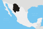
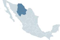
Chihuahua (Spanish pronunciation: [tʃiˈwawa]) is a state in north western Mexico with a mainland area of 247,087 square kilometers (95,400.8 sq mi),[2] slightly larger than the United Kingdom. It is surrounded by the states of Sonora to the west, Sinaloa to the south-west, Durango to the south, and Coahuila to the east, and by the U.S. states of Texas to the north-east and New Mexico to the north. Chihuahua is the largest state in Mexico by area, and is consequently known under the nickname El Estado Grande ("The Big State"). Although Chihuahua is primarily identified the Chihuahuan Desert for namesake, it has more forests than any other state in Mexico. Due to its variant climate the state boasts a large variety of fauna and flora. The state is mostly characterized by rugged mountainous terrain and wide river valleys. The Sierra Madre Occidental mountain range, an extension of the Rocky Mountains, dominates the state's terrain and is home to the state's greatest attraction, La Barranca del Cobre, or Copper Canyon, a spectacular canyon system larger and deeper than the Grand Canyon. On the slope of the Sierra Madre Occidental mountains (around the regions of Casas Grandes, Cuauhtémoc and Parral), there are vast prairies of short yellow grass, the source of the bulk of the state's agricultural production. Most of the 3.2 million inhabitants (2005) live along the Rio Grande Valley and the Conchos River Valley.
The etymology of the name Chihuahua has long been disputed by historians and linguists. The most accepted theory explains that the name was derived from the Nahuatl language meaning "The place where the water of the rivers meet". Chihuahua was inhabited for thousands of years by native tribes with diverse cultures. During the mid 16th century, the Spanish became interested in the area for its potential mineral wealth. The sparse native population sometimes fervently opposed Spanish rule, but the state was soon overtaken by European immigrants. Mining towns and Catholic missions were the first European settlements. Chihuahua was an important launch site for the exploration and settlement of the southwestern part of the United States by Spanish explorers during the 16th and 17th centuries. Later the state offered a vital commercial route between settlements in New Mexico and Mexico City. During the 19th century, a large wave of German immigrants came to the state seeking religious freedom known as Mennonites. Throughout history it has been the battlefield of many internal Mexican conflicts and international conflicts between Mexico and the United States.
Chihuahua has a diversified state economy. The three most important economic centers in the state are: Ciudad Juárez, an international manufacturing center; Chihuahua, the state capital; and Delicias, the state's main agriculture hub. Today Chihuahua serves as an important commercial route prospering from billions of dollars from international trade as a result of NAFTA. On the other hand the state suffers the fallout of illicit trade and activities especially at the border.
On February 6, 2010, Governor Baeza proposed to move the three State Powers (Executive, Legislative and Judicial) from Chihuahua to Ciudad Juárez in order to face the insecurity problems in the latter city,[3] but that request was rejected by the State Legislature on February 12.[4]
Contents |
History
Prehistory

The earliest evidence of human inhabitants of modern day Chihuahua was discovered in the area of Samalayuca and Rancho Colorado. Clovis points have been found in northeastern Chihuahua that have been dated between 12000 BC to 7000 BC. It is thought that these inhabitants were hunter gatherers. Inhabitants of the state later developed farming with the domestication of corn. Archeological evidence in northern Chihuahua known as Cerro Juanaqueña revealed squash cultivation, primitive irrigation techniques, and ceramic artifacts all dated around 2000 BC.[5]
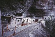
Between 300-1300 AD in the northern part of the state along the wide, fertile valley on the San Miguel River the Casas Grandes (Big Houses) culture developed into an advance civilization. The Casas Grandes civilization is part of a major prehistoric archaeological culture known as Mogollon which is related to the Anasazi. Paquime was the center of the Casas Grandes civilization. There is extensive archeological evidence of commerce, agriculture, and hunting at Paquime and Cuarenta Casas (Forty Houses).
Cuarenta Casas also known as La Cueva De Las Ventanas (The Cave of Windows) are a series of cliff dwellings along an important trade route. Cuarenta Casas is thought to have been a branch settlement from Paquime to protect the trade route from attack. Archeologists believe the civilization began to decline during the 13th century and by the 15th century the inhabitants of Paquime sought refuge in the Sierra Madre Occidental while others are thought to have immigrated north and joined the Anasazi. According to anthropologist current natives tribes (Yaqui, Mayo, Opata, and Tarahumara) are descendants of the Casas Grandes culture.
During the 14th century in the northeastern part of the state nomad tribes by the name of Jornado hunted bison along the Rio Grande; they left numerous rock paintings throughout the northeastern part of the state. When the Spanish explorers reached this area they found their descendants, Suma and Manso tribes. Between 300- 1300 AD in the southern part of the state in a zone known as Aridoamerica the Chichimeca cuture survived by hunting, gathering, and farming. The Chichimeca are the ancestors of the Tepehuane tribe.
Colonial Era

Nueva Vizcaya (New Biscay) was the first province of northern New Spain to be explored and settled by the Spanish. Around 1528, a group of Spaniard explorers, led by Álvar Núñez Cabeza de Vaca, first entered the actual territory of what is now Chihuahua. The conquest of the territory lasted nearly one century, and encountered fierce resistance from the Conchos tribe, but the desire of the Spanish Crown to transform the region into a bustling mining center led to a strong strategy to control the area.
In 1562 Francisco de Ibarra headed a personal expedition in search of the mythical cities of Cibola and Quivira; he traveled through the present-day state of Chihuahua. Francisco de Ibarra is thought to have been the first European to see the ruins of Paquime. In 1564 Rodrigo de Río de Loza, a lieutenant under Francisco de Ibarra, stayed behind after the expedition and found gold at the foot of the mountains of the Sierra Madre Occidental; he founded the first Spanish city in the region, Santa Barbara by bringing 400 European families to the settlement.

A few years later in 1569 Franciscan missionaries led by Fray Agustín Rodríguez from the coast of Sinaloa and the state of Durango founded the first mission in the state in Valle de San Bartolomé (present-day Valle de Allende). Fray Agustín Rodríguez evangelized the native population until 1581. Between 1586 and 1588 a epidemic caused a temporary exodus of the small population in the territory of Nueva Vizcaya.
Santa Bárbara became the launching place for expeditions into New Mexico by Spanish conquistadors like: Antonio de Espejo, Gaspar Castaño, Antonio Gutiérrez de Umaña, Francisco Leyba de Bonilla, and Vicente de Zaldívar. Several expeditions were led to find a shorter route from Santa Barbara to New Mexico. In April 1598, Juan de Oñate finally found a short route from Santa Barbara to New Mexico which came to be called El Paso del Norte (The Northern Pass). The discovery of El Paso Del Norte was important for the expansion of El Camino Real de Tierra Adentro (The Inner Land Royal Road) to link Spanish settlements in New Mexico to Mexico City; El Camino Real de Tierra Adentro facilitated transport of settlers and supplies to New Mexico.
Many other mining towns, missions and presidios were founded in the region Santa Eulalia and Camargo. In 1631 Noah Carrasco de Biesma discovered a rich vein of silver, and subsequently established San Jose del Parral near the site. Parral remained an important economic and cultural center for the next 300 years. On December 8, 1659 Fray García de San Francisco founded the mission of Nuestra Señora de Guadalupe de Mansos del Paso del Río del Norte and founded the town El Paso Del Norte (present day Ciudad Juárez) in 1667. The Spanish society that developed in the region replaced the sparse population of indigenous peoples. The absence of servants and workers forged the spirit of northern people as self-dependent, creative people that defended their European heritage. In 1680 settlers from Santa Fe, New Mexico sought refuge in El Paso Del Norte for twelve years after fleeing the attacks from Pueblo tribes, but returned back to Santa Fe in 1692 after Diego de Vargas recaptured the city and vicinity.
Constituent legislatures
In the constituent legislature or convention, the conservative and liberal elements formed using the nicknames of Chirrines and Cuchas. The military entered as a third party. The elections for the first regular legislature were disputed, and it was not until May 1, 1826, that the body was installed. The liberals gained control and the opposition responded by fomenting a conspiracy. This was promptly stopped with the aid of informers, and more strenuous measures were taken against the conservatives. Extra powers were conferred on the Durango governor, Santiago Baca Ortiz, deputy to the first national congress, and leader of the liberal party.[6]
Gonzalez’s rebellion
Opponents continued to plot against the new government. In March 1827, Lieutenant J.M. González proclaimed himself comandante general, arrested the governor, and dissolved the legislature. General Parras was sent to suppress the movement. Comandante general J. J. Ayestaran was replaced by José Figueroa. When elections failed, the government intervened in favor of the Yorkino party, which had elected Vicente Guerrero to the presidency.[6]
Because of the general instability of the federal government during 1828, the installation of the new legislature did not take place until the middle of the following year. It was quickly dissolved by Governor Baca, who replaced it with a more pronounced Yorkino type. When Guerrero's liberal administration was overthrown in December, Gaspar de Ochoa aligned with Anastasio Bustamante, and in February 1830, organized an opposition group that arrested the new governor, F. Elorriaga, along with other prominent Yorkinos. He then summoned the legislature, which had been dissolved by Baca. The civil and military authorities were now headed by J. A. Pescador and Ochoa.[6]
Vicente Guerrero
The general features of the preceding occurrence applied also to Chihuahua, although in a modified form. The first person elected under the new constitution of 1825 was Simón Elías Gonzalez, who being in Sonora, was induced to remain there. J. A. Arce took his place as ruler in Chihuahua. In 1829, González became comandante general of Chihuahua, when his term of office on the west coast expired. Arce was less of a yorkino than his confrere of Durango. Although unable to resist the popular demand for the expulsion of the Spaniards, he soon quarreled with the legislature, which declared itself firmly for Guerrero, and announcing his support of Bustamante's revolution, he suspended, in March 1830, eight members of that body, the vice-governor, and several other officials, and expelled them from the state. The course thus outlined was followed by Governor J. I. Madero, who succeeded in 1831, associated with J. J. Calvo as comandante general, stringent laws being issued against secret societies, which were supposed to be the main spring to the anti-clerical feeling among liberals.[6]
Durango and Bustamante
The anti-clerical feeling was widespread, and Durango supported the initial reaction against the government at Mexico. In May 1832, José Urrea, a rising officer, supported the restoration of President Pedraza. On July 20, Governor Elorriaga was reinstated, and Baca along with the legislative minority were brought back to form a new legislature, which met on September 1. Chihuahua showied no desire to imitate the revolutionary movement and Urrea prepared to invade the state. Comandante-general J.J.Calvo threatened to retaliate, and a conflict seemed imminent. The entry of General Santa Anna into Mexico brought calm, as the leaders waited for clarity.[6]
Santa Anna

Bishop Zubiria was banished for resisting the law relating to priests and other encroachments on the church; another joined the western states in a short lived coalition for sustaining the federal system. Chihuahua adopted the Cuernavaca Plan in July 1834 while President Valentín Gómez Farías was in power. Because the plan was not enforced, commanding officer, Colonel J.I. Gutiérrez, declared the term of the legislature and governor expired on September 3. At a convention of citizens called to select a new provisional ruler, Gutierrez obtained the vote, with P. J. Escalante for his deputy, and a council to guide the administration.[6] Santa Anna ordered the reinstatement of Mendarozqueta as comandante general. Gutiérrez yielded, but Escalante refused to surrender office, demonstrations of support ensued, but Escalante yielded when troops were summoned from Zacatecas. A new election brought a new legislature, and conforming governors. In September 1835 José Urrea a federalist army officer came into power.[6]
Comandante general Simón Elías González, was nominated governor and military command was given to Colonel J.J. Calvo, whose firmness had earned well-merited praise. The state was in the midst of a war with the Apaches, which became the focus of all their energy and resources. After a review of the situation, Simón Elías González declared that the interests of the territory would be best served by uniting the civil and military power, at least while the campaign lasted. He resigned under opposition, but was renominated in 1837.[6]
Mexican American War
The state seemed at relative calm compared to the rest of the country due to its close ties to the United States until 1841. In 1843 the possibility of war was anticipated by the state government and began to reinforce the defense lines along the political boundary with Texas. Supplies of weapons were sent to fully equip the military and took steps to improve efficiency at the presidios. Later, the Regimen for the Defenders of the Border were organized by the state which were made up of: light cavalry, four squads of two brigades, and a small force of 14 men and 42 officials at the price of 160,603 pesos per year. During the beginning of the 1840s, private citizens took it upon themselves to stop the commercial caravans of supplies from the United States, but being so far away from the large suppliers in central Mexico the caravan was allowed to continue in march 1844. Continuing to anticipate a war, the state legislature on July 11, 1846 by decree enlisted 6,000 men to serve along the border. During that time Ángel Trías rose to power in the state a zealous anti-American rhetoric. Ángel Trías took the opportunity to dedicate important state resources to gain economic concessions from the people and loans from many municipalities in preparation to defend the state; he used all the money he received to equip and organize a large volunteer militia. Ángel Trías took measures for state self dependence in regards to state militia due to the diminishing financial support from the federal government.
The United States Congress declared war on Mexico on May 13, 1846 after only having a few hours to debate. Although President José Mariano Paredes's issuance of a manifesto on May 23 is sometimes considered the declaration of war, Mexico officially declared war by Congress on July 7. After the American invasion of New Mexico, Chihuahua sent 12,000 men led by Coronel Vidal to the border to stop the American military advance into the state. The Mexican forces being impatient to confront the American forces passed beyond El Paso del Norte about 20 miles north along the Rio Grande. The first battle that Chihuahua fought was the battle of El Bracito; the Mexican forces consisting of 500 calvary and 70 infantry confronted a force of 1100-1200 Americans on December 25, 1846. The battle ended badly by the Mexican forces that were then forced to retreat back into the state of Chihuahua. By December 27, 1846, the American forces occupied El Paso Del Norte. General Doniphan maintained camp in El Paso Del Norte awaiting supplies and artillery which he received in February 1847.
On February 8, 1847, Doniphan continued his march with 924 men mostly from Missouri; he accompanied a train of 315 wagons of a large commercial caravan heading to the state capital. Meanwhile, the Mexican forces in the state had time to prepare a defense against the Americans. About 20 miles north of the capital two mountain ranges join from east to west and is the only pass into the capital known as Sacramento Pass, this point is now part of present-day Chihuahua City. The Battle of Sacramento was the most important battle fought in the state of Chihuahua because it was the sole defense for the state capital. The battle ended quickly because of some devastating defensive errors from the Mexican forces and the ingenious strategical moves by the American forces. After their loss at the Battle of Sacramento, the remaining Mexican soldiers retreated south, leaving the city to American occupation. Almost 300 Mexicans were killed in the battle, as well as almost 300 wounded. The Americans also confiscated large amounts of Mexican supplies and took 400 Mexican soldiers prisoners of war. American forces maintained an occupation of the state capital for the rest of the Mexican American War.

The Treaty of Guadalupe Hidalgo, signed on February 2, 1848, by American diplomat Nicholas Trist and Mexican plenipotentiary representatives Luis G. Cuevas, Bernardo Couto, and Miguel Atristain, ended the war and gave the U.S. undisputed control of Texas, established the U.S.-Mexican border of the Rio Grande River. As news of peace negotiations reached the state tended to settle Mexican new call to arms But as the Mexican officials in Chihuahua heard that General Price was heading back to Mexico with a large force comprised with several companies of infantry and three companies of calvary and one division of light artillery from Santa Fe on February, 8 1948, Ángel Trías sent a message to Sacramento Pass to ask for succession of the area as they understood the war had concluded. General Price misunderstanding this as a deception by the Mexican forces continued to advance towards the state capital. On March 16, 1848 Price began negotiations with Ángel Trías, but the Mexican leader responded with an ultimatum to General Price. The American forces engaged with the Mexican forces near Santa Cruz de los Rosales on March 16, 1848. The Battle of Santa Cruz de los Rosales was the last battle of the Mexican American War and it occurred after the peace treaty was signed. The American forces maintained control over the state capital for three months after the confirmation of the peace treaty. The American presence served to help avoid the possible succession of the state which had been discussed at the end of 1847.
During the American occupation of the state, the number of Indian attacks were drastically reduced, but in 1848 the attack resumed to such a degree that the Mexican officials had no choice but to resume military projects to protect Mexican settlements in the state. Through the next three decades the state faced constant attacks from indigenous on Mexican settlements. After the occupation the people of the state were worried about the potential attack from the hostile indigenous tribes north of the Rio Grande; as a result a decree on July 19, 1848 the state established 18 military colonies along the Rio Grande. The new military colonies were to replace the presidios as population centers to prevent future invasions by indigenous tribes; these policies remained prominent in the state until 1883. Eventually the state replaced the old state security with a state policy to form militias organized with every Mexican in the state capable to serve between the ages of 18-55 to fulfill the mandate of having 6 men defending for every 1000 residents.
Geography

The state of Chihuahua is the largest state in the country and is known as El Estado Grande (The Big State); it accounts for 12.6% of the land of Mexico. The state landlocked by the states of Sonora to the west, Sinaloa to the south-west, Durango to the south, and Coahuila to the east, and by the U.S. states of Texas to the north-east and New Mexico to the north. The state is made up of three geologic regions: Mountains, Plains-Valleys, and Desert which occur in large bands from west to east. Because of the different geologic regions there are contrasting climates and ecosystems.

The main mountain range in the state is the Sierra Madre Occidental reaching a maximum altitude of 10,826 ft (3,300 m) known as Cerro Mohinora. Mountains account for one third of the state's surface area which include large coniferous forests. The climate in the mountainous regions varies Chihuahua has more forests than any other state in Mexico making the area a bountiful source of wood; the mountainous areas are rich in minerals important to Mexico's mining industry. Precipitation and temperature in the mountainous areas depends on the elevation. Between the months of November and March snow storms are possible in the lower elevations and are frequent in the higher elevations. There are several watersheds located in the Sierra Madre Occidental all of the water that flows through the state; most of the rivers finally empty into the Rio Grande. Temperatures in some canyons in the state reach over 100°F in the summer while the same areas rarely drop below 32°F in the winter. There are microclimates found in the heart of the Sierra Madre Occidental in the state that could be considered tropical and there have been wild tropical plants found in some canyons. La Barranca del Cobre, or Copper Canyon, a spectacular canyon system larger and deeper than the Grand Canyon; the canyon also contains Mexico's two tallest waterfalls: Basaseachic Falls and Piedra Volada. There are two national parks found in the mountainous area of the state: Cumbres de Majalca National Park and Basaseachic Falls National Park.
The plains at the foot of the Sierra Madre Occidental is an elongated mesa known as Altiplanicie Mexicana that exhibits a steppe climate and serves as a transition zone from the mountain climate in the western part of the state to the desert climate in the eastern side of the state.

The steppe zone accounts for a third of the state's area, and it experiences pronounced dry and wet seasons. The pronounced rainy season in the steppe is usually observed in the months of July, August, and September. The steppe also encounters extreme temperatures that often reach over 100°F in the summer and drop below 32°F in the winter. The steppe zone is an important agriculture zone due to an extensive development of canals exploiting several rivers that flow down from the mountains. The steppe zone is the most populated area of the state.
The most important river in the state is Rio Conchos which is the largest tributary to the Rio Grande from the Mexican side; the river descends from the zenith of the Sierra Madre Occidental in the southwest part of the state an winds through the center of the state where the water is exploited in the steppe zone and it eventually empties into the Rio Grande in the small desert town of Ojinaga.
The desert zone also accounts for about a third of the state's surface area. The Chihuahuan Desert is an international biome that also extends into the neighboring Mexican state of Coahuila and into the US states of Texas and New Mexico. The desert zone is mainly of flat topography with some small mountain ranges that run north to south. The desert in the state varies slightly with a small variant in climate. The lower elevations of the desert zone are found in the north along the Rio Grande which experience hotter temperatures in the summer and winter while the southern portion of the desert zone experiences cooler temperatures due to its higher elevation. Samalayuca covers an area of about 150 square kilometers; it is an impressive site of the Chihuahuan Desert and is a protected area by the state due to unique species of plants and animals that can only be found in that area.
Climate
The climate in the state depends mainly in the elevation of the terrain. According to Köppen climate classification the state has five major climate zones. The Sierra Madre Occidental dominates the western part of the state; there are two main climates in this area: Subtropical Highland (Cfb) and Humid Subtropical (Cwa). There are some microclimates in the state due to the varying topology mostly found in the western side of the state. The two best known microclimates are: Tropical savanna climate (Aw) in deep canyons located in the extreme southern part of the state; Continental Mediterranean climate (Dsb) in the extremely high elevations of the Sierra Madre Occidental. Satellite image to the right shows the vegetation is much greener in the west because of the cooler temperatures and larger amounts of precipitation as compared to the rest of the state.
In the far eastern part of the state the Chihuahuan Desert dominates due to low precipitation and extremely high temperatures; some areas of the eastern part of the state are so dry no vegetation is found like the Sand Dunes of Samalayuca. There are two distinctive climate zones found in the eastern part of the state: Hot Desert (BWh) and Cool Desert (BWk) which are differentiated by average annual temperature due to differences in elevation. There is a transition zone in the middle of the state between the two extremely different climates from the east and west; this zone is the Steppe characterized by a compromise between juxtaposed climate zones.

| Subtropical Highland Cfb Humid Subtropical Cwa Steppe BSk Hot Desert BWh Cool Desert BWk |
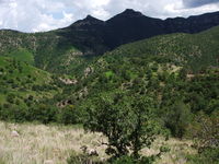

- Subtropical Highland (Cfb) most common at elevations above 7,200 ft above sea level; this climate zone has warm summers reaching a maximum temperature of 82°F and summer lows of 50°F. Heavy rainstorms are observed from July to September. Winters are cold reaching a maximum low of -4°F and a maximum high of 17°F. During the winter months many snowstorms are observed with typically 1 meter (~3 ft) of snow per season.
- Humid Subtropical (Cwa) climate is most common at elevations between 4,200-7,200 ft above sea level; this climate zone has warm humid summers and an average summer temperature of 68°F. The summer average precipitation is 70 cm (28 in) mostly in the months of: July, August, and September. From November to March there are many rainstorms and snowstorms caused by high elevation and prominent cold fronts. Winter temperatures can reach a low of 3°F.
- Semi-arid climate or Steppe (BSk) is most common at elevations between 4,000-5,000 ft above sea level; this climate zone has an annual average 64°F and maximum temperatures above of 100°F and lows reaching slightly below 32°F. With a wet season in the late summer and fall. Snowfall is rare but possible in the winter and frost is common from December to March. The annual average rainfall in the steppe climate zone is about 18.7 inches.
- Hot Desert (BWh) is most common at elevations below 4,000 ft above sea level; this climate zone tends to have a hot summer at temperatures that often reach 110 °F. Winter is warm rarely dropping below 32°F. Precipitation averages between 6-10 in per year; most of the moisture falls during the "monsoon" of late summer.
- Cool Desert (BWk) is most common at elevations below 4,000 ft above sea level; this climate zone tends to have a mild summer rarely reaching temperatures over 105 °F. Winter weather varies from mild to cold depending on northern fronts often dropping below 32°F. Precipitation averages between 10-16 in per year; most of the moisture falls during the "monsoon" of late summer.
Flora and Fauna


The state has a great diversity due to the large number of microclimates found and dramatic varying terrain. The flora throughout the Sierra Madre Occidental mountain range varies with elevation. Pine (Pinus) and Oak (Quercus) species are usually found at an elevation of 2,000 meters (6,560 ft) above sea level. The most common species of flora found in the mountains are: Pinus, Quercus, Abies, Ficus, Vachellia, Ipomoea, Acacia, Lysiloma, Bursera, Vitex, Tabebuia, Sideroxylon, Cordia, Fouquieria, Pithecellobium.[7] The state is home to one of the largest variation species of the genus Pinus in the world. The lower elevations have a steppe vegetation with a variety of grasses and small bushes. Several species of Juniperus dot the steppe and the transition zone.
According to the World Wide Fund for Nature, the Chihuahuan Desert may be the most biologically diverse desert in the world, whether measured on species richness or endemism, although the region has been heavily degraded over time. Many native species have been replaced with creosote shrubs. The most common desert flora in the state includes: Agave, Larrea, Prosopis, Fouquieria, Dasylirion, Yucca, Poaceae, Lophophora,Opuntia, Echinocereus, Baileya, Chilopsis, Eucnide, and Hylocereus.
The fauna in the state is just as diverse as the flora and varies greatly due to the large contrast in climates. In the mountain zone of the state the most observed mammals are: Mexican Fox Squirrel (Sciurus nayaritensis), Antelope Jackrabbit (Lepus alleni), Raccoon (Procyon lotor), Hooded Skunk (Mephitis macroura), Wild Boar (Sus scrofa), Collared Peccary (Pecari tajacu), White-tailed Deer (Odocoileus virginianus), Mule Deer Odocoileus hemionus, American bison Bison bison, Cougar (Puma concolor), Eastern Cottontail Sylvilagus floridanus, North American Porcupine Erethizon dorsatum, Bobcat Lynx rufus, ; Mexican WolfCanis lupus baileyi, and Coyote Canis latrans. American Black BearUrsus americanus is also found but in very small numbers. The Mexican wolf, once abundant, has been extirpated. The main cause of degradation has been grazing.[8] Although there are many reptilian species in the mountains the most observed species include: Northern Mexican Pine Snake, Pituophis deppei jani, Texas Horned Lizard (Phrynosoma cornutum), Rock Rattlesnake (Crotalus lepidus), Black-tail Rattlesnake (Crotalus molossus). Plateau Tiger Salamander Ambystoma velasci is one of possible many amphibians to be found in the mountains.
The Chihuahuan Desert is home to a diverse ecosystem which is home to a large variety of mammals. The most common mammals in the desert include: Desert Cottontail Sylvilagus audubonii; Black-tailed Jackrabbit Lepus californicus; Hooded Skunk Mephitis macroura; Cactus Mouse Peromyscus eremicus; Swift Fox Vulpes velox; White-Throated Woodrat Neotoma albigula; Pallid bat Antrozous pallidus; and Coyote Canis latrans. The most observed reptiles in the desert include: Mohave rattlesnake Crotalus scutulatus, Twin-spotted rattlesnake Crotalus pricei, Prairie rattlesnake Crotalus viridis, Ridge-nosed rattlesnake Crotalus willardi; Whip Snake Masticophis flagellum; New Mexico Whiptail Cnemidophorus neomexicanus; Red-spotted Toad Bufo punctatus.
The state is also a host to a large population of birds which include endemic species and migratory species: Greater Roadrunner Geococcyx californianus; Cactus Wren Campylorhynchus brunneicapillus; Mexican Jay Aphelocoma ultramarina; Steller's Jay Cyanocitta stelleri; Acorn Woodpecker Melanerpes formicivorus; Canyon Towhee Pipilo fuscus; Mourning Dove Zenaida macroura; Broad-billed Hummingbird Cynanthus latirostris; Montezuma Quail Cyrtonyx montezumae; Mountain Trogon Trogon mexicanus; Turkey Vulture Cathartes aura; and Golden Eagle Aquila chrysaetos. Trogon mexicanus is endemic species found in the mountains in Mexico; it is considered an endangered species and has symbolic significance to Mexicans.[9]
Demography

| 250-1,000 persons per km² 25-249 persons per km² 5-24 persons per km² 1-4 persons per km² |
| Population History of Chihuahua |
|
| Year | Population |
|---|---|
| 1930 | 491,792 |
| 1940 | 623,944 |
| 1950 | 846,414 |
| 1960 | 1,226,793 |
| 1970 | 1,612,525 |
| 1980 | 2,005,477 |
| 1990 | 2,441,873 |
| 2000 | 3,052,907 |
| 2005 | 3,241,444 |

According to the census by the Instituto Nacional de Estadística y Geografía (INEGI) in 2005, the state population is 3,241,444 making the state the 11th most populated state in Mexico. Census recorded 1,610,275 men and 1,631,169 women..[11] The median age of the population is 25 years of age.[12] The northern state is placed seventh in the nation regarding quality of life and sixth in terms of life expectancy at 75.2 years of age.
During the period from 2000-2005 it is estimated that 49,722 people left the state for the United States. 82,000 people are thought to have immigrated to the state from 2000-2005 mainly coming from Veracruz (17.6%), United States (16.2%), Durango (13.2%), Coahuila (8.0%) y Chiapas (4.5%). It is believed that there is a large number of undocumented immigrants in that state the come from Central and South America which mainly settle in Ciudad Juárez. According the to the 2005 census, the population grew 1.06% from 2000 to 2005. The state has an uneven settlement of people and the lowest population density of any Mexican state; according to the 2005 census there were 12 people per square kilometer.[13] Of all the 3,241,444 people in the state, two thirds live in the cities of Ciudad Juárez and Chihuahua accounting together 2,072,129. Only three cities have more than one hundred thousand: Parral 101,147; Cuauhtémoc 105,725; and Delicias 108,187.
Ethnic Groups
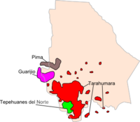
| Tarahumara Tepehuan Del Norte Guarijío Pima |
Chihuahua holds one of the largest proportion of white population of Mexico, as is the case in much of northern Mexico. Caucasians make up 55% of the population, most of them of Spaniard origin, but also of French, Basque, Italian, German, Dutch and Middle Eastern descent, while the rest of the population are Mestizo groups of predominant Spaniard descent. Indians form 5% of the state inhabitants and remain isolated in the woods of southwestern Chihuahua. The admixture with Indians never existed in Nueva Vizcaya due to the scarcity of natives (most of them warrior and anti-European Conchos and Tarahumaras), and the size of the territory. The most important indigenous tribes of the state of Chihuahua are:

- Tarahumara: The largest tribe of indigenous people in the state. They call themselves Rarámuri which means "Barefoot Runner". They are famous for their endurance in running long distances. They live in large areas of the Sierra Madre Occidental. Many of the tribe have immigrated to the large cities of the state mainly for economic incentives.
- Tepehuan Del Norte: A tribe differentiated from the Tepehuan that live in the state of Durango by their language. The tribe lives near the small towns of Guadalupe y Calvo and Baborigame.
- Guarijío: A small tribe that is differentiated from the other tribes of the state by their language. Little is known about these indigenous tribes except that they live near the small villages of Chínipas and Uruachi.
- Pima: A large tribe of people that live in across extensive areas of northwestern Mexico and southwestern United States. The population of the tribe in the state is small mostly around the town of Temósachi. Although all the tribe speaks the same language variant dialects have been discovered between different settlements.
Religion
Population of 5 years and older claim to be the following religious beliefs.
| Religion | Percent |
|---|---|
| Catholic | 84.6%[14] |
| Protestant | 7.1%[15] |
| Christian | 2.0%[16] |
| Atheist | 5.1%[17] |
Main Cities

The state has one city with a population exceeding one million, Ciudad Juárez. Ciudad Juárez is ranked 8th most populous city in the country and Chihuahua City was ranked 16th most populous in Mexico. Chihuahua is the only state in Mexico to have two cities ranked in the top 20 most populated. El Paso and Ciudad Juárez comprise one of the largest bi-national metropolitan areas in the world with a combined population of 2.4 million people. In fact, Ciudad Juárez is one of the fastest growing cities in the world in spite of the fact that it is "the most violent zone in the world outside of declared war zones."[18] For instance, a few years ago the Federal Reserve Bank of Dallas published that in Ciudad Juárez “the average annual growth over the 10-year period 1990-2000 was 5.3 percent. Juárez experienced much higher population growth than the state of Chihuahua and than Mexico as a whole.”[19] Chihuahua City has one of the highest literacy rates in the country at 98%; 35% of the population is aged 14 or below, 60% between 15-65 and 5% over 65[20]. The growth rate is 2.4%.[20] El 76.5%[21] of the population of the state of Chihuahua live in cities which makes the state one of the most urbanized in Mexico.
| Cities of Chihuahua (Conteo de Población y Vivienda 2005)[22] |
||||||
|---|---|---|---|---|---|---|
| Rank | City | Municipality | Population 2000 | Population 2005 | ||
| 1 | Ciudad Juárez | Juárez | 1,187,275 | 1,301,452 | ||
| 2 | Chihuahua City | Chihuahua | 657,876 | 748,518 | ||
| 3 | Delicias | Delicias | 98,615 | 108,187 | ||
| 4 | Ciudad Cuauhtémoc | Cuauhtémoc | 98,876 | 125,725 | ||
| 5 | Parral | Hidalgo del Parral | 85,387 | 101,147 | ||
| 6 | Nueva Casas Grandes | Nueva Casas Grandes | 50,378 | 50,863 | ||
| 7 | Camargo | Camargo | 37,456 | 39,149 | ||
| 9 | Ciudad Jiménez | Jiménez | 29,895 | 33,567 | ||

Education
Average schooling is 8.5 years, which means that in general the average citizen over 15 years of age has gone as far as a second year in secondary education. On the other hand, 9 out of 100 inhabitants has a professional degree.
Institutions of higher education include:
- Instituto Tecnológico de Chihuahua
- Instituto Tecnológico de Chihuahua II
- Universidad Autónoma de Chihuahua
- Instituto Tecnólogico y de Estudios Superiores de Monterrey Campus Chihuahua
- Universidad La Salle
- Universidad Tecnológica de Chihuahua
Government
Administrative divisions
| Municipalities of the State of Chihuahua | |||||
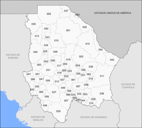 |
|||||
| Number | Municipality | Municipal Seat | Number | Municipality | Municipal Seat |
|---|---|---|---|---|---|
| 001 | Ahumada | Villa Ahumada | 035 | Janos | Janos |
| 002 | Aldama | Aldama | 036 | Jiménez | Ciudad Jiménez |
| 003 | Allende | Valle de Allende | 037 | Juárez | Ciudad Juárez |
| 004 | Aquiles Serdán | Santa Eulalia | 038 | Julimes | Julimes |
| 005 | Ascensión | Ascensión | 039 | López | Villa López |
| 006 | Bachíniva | Bachíniva | 040 | Madera | Ciudad Madera |
| 007 | Balleza | Mariano Balleza | 041 | Maguarichi | Maguarichi |
| 008 | Batopilas | Batopilas | 042 | Manuel Benavides | Manuel Benavides |
| 009 | Bocoyna | Bocoyna | 043 | Matachí | Matachí |
| 010 | Buenaventura | San Buenaventura | 044 | Matamoros | Villa Matamoros |
| 011 | Camargo | Camargo | 045 | Meoqui | Meoqui |
| 012 | Carichí | Carichí | 046 | Morelos | Morelos |
| 013 | Casas Grandes | Casas Grandes | 047 | Moris | Moris |
| 014 | Coronado | Villa Coronado | 048 | Namiquipa | Namiquipa |
| 015 | Coyame del Sotol | Coyame | 049 | Nonoava | Nonoava |
| 016 | La Cruz | La Cruz | 050 | Nuevo Casas Grandes | Nuevo Casas Grandes |
| 017 | Cuauhtémoc | Cuauhtémoc | 051 | Ocampo | Melchor Ocampo |
| 018 | Cusihuiriachi | Cusihuiriachi | 052 | Ojinaga | Ojinaga |
| 019 | Chihuahua | Chihuahua | 053 | Práxedis G. Guerrero | Práxedis G. Guerrero |
| 020 | Chínipas | Villa Chínipas de Almada | 054 | Riva Palacio | San Andrés |
| 021 | Delicias | Delicias | 055 | Rosales | Santa Cruz de Rosales |
| 022 | Dr. Belisario Domínguez | San Lorenzo | 056 | Rosario | Valle del Rosario |
| 023 | Galeana | Hermenegildo Galeana | 057 | San Francisco de Borja | San Francisco de Borja |
| 024 | Santa Isabel | Santa Isabel | 058 | San Francisco de Conchos | San Francisco de Conchos |
| 025 | Gómez Farías | Valentín Gómez Farías | 059 | San Francisco del Oro | San Francisco del Oro |
| 026 | Gran Morelos | San Nicolás de Carretas | 060 | Santa Bárbara | Santa Bárbara |
| 027 | Guachochi | Guachochi | 061 | Satevó | Satevó |
| 028 | Guadalupe | Guadalupe | 062 | Saucillo | Saucillo |
| 029 | Guadalupe y Calvo | Guadalupe y Calvo | 063 | Temósachi | Temósachi |
| 030 | Guazapares | Témoris | 064 | El Tule | El Tule |
| 031 | Guerrero | Guerrero | 065 | Urique | Urique |
| 032 | Hidalgo del Parral | Hidalgo del Parral | 066 | Uruachi | Uruachi |
| 033 | Huejotitán | Huejotitán | 067 | Valle de Zaragoza | Valle de Zaragoza |
| 034 | Ignacio Zaragoza | Ignacio Zaragoza | |||
Chihuahua is subdivided into 67 municipios (municipalities). S
Economy
As of 2005, Chihuahua's economy represents 4.5% of Mexico's total gross domestic product or 29,826 million USD.[23] Chihuahua's economy has a strong focus on export oriented manufacturing (i.e. maquiladora). As of 2005, 329,939 people are employed in the manufacturing sector.[24] There are a more than 406 companies operating under the federal IMMEX or Prosec program in Chihuahua. The average wage for an employee in Chihuahua is approximately 193 pesos per day.[25]
In fiction
- In the Harry Turtledove novel How Few Remain, Chihuahua (along with Sonora) is annexed into a fictional Confederate States of America in the 1880s. In all eleven novels of the timeline-191 series, Chihuahua and Sonora function as part of the Confederacy.
Gallery
|
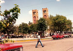
Metropolitan cathedral of Chihuahua, Chih. |
 Plaza de Armas of Chihuahua, Chih. |
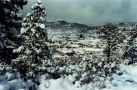
Chihuahua during a snowfall |
See also
- Geography of Mexico
References
- ↑ "La diputación provincial y el federalismo mexicano" (in Spanish). http://books.google.com.mx/books?id=i_GK_-6deKIC&pg=PA227&lpg=PA227&dq=22+De+Mayo+De+1824+durango&source=bl&ots=eyvDzsrMIz&sig=zYxzmtG7gTQgGV-WNDfHgqcG_kU&hl=es&ei=FtAxS9joN56ltgf-_ojFDg&sa=X&oi=book_result&ct=result&resnum=1&ved=0CAgQ6AEwAA#v=onepage&q=22%20De%20Mayo%20De%201824%20durango&f=false.
- ↑ Microsoft Encarta Premium 2009
- ↑ Correspondents (6 February 2010). "Trasladan Poderes de Chihuahua a Juárez" (in Spanish). El Universal. http://www.eluniversal.com.mx/notas/656753.html. Retrieved 2010-02-07.
- ↑ Correspondents (12 February 2010). "Diputados dicen no al traslado de Poderes" (in Spanish). El Universal. http://www.eluniversal.com.mx/notas/658391.html. Retrieved 2010-02-12.
- ↑ http://www.thamesandhudsonusa.com/web/humanpast/summaries/ch09.html en Inglés
- ↑ 6.0 6.1 6.2 6.3 6.4 6.5 6.6 6.7 History Of The North Mexican States And Texas, Vol. II 1801-1889, San Francisco, The History Company, Publishers, 1889, Chapter 24
- ↑ http://redalyc.uaemex.mx/redalyc/html/341/34100203/34100203.html
- ↑ Chihuahua Desert Ecoregion, World Wild Fund for Nature
- ↑ http://www.mexicodesconocido.com.mx/notas/7235-Candame%F1a-(Chihuahua)
- ↑ http://www.inegi.org.mx/sistemas/biblioteca/detalle.aspx?c=16632&upc=702825494384&s=est&tg=0&f=2&pf=Pob
- ↑ = mpob02&c = 3179 Población total por entidad federativa según sexo, 2000 y 2005 INEGI
- ↑ = mpob07&c = 3184 Edad mediana por entidad federativa según sexo, 2000 y 2005 INEGI
- ↑ = mpob11&c = 3188 Densidad de población por entidad federativa, 2000 INEGI
- ↑ = mrel07&c = 4140&e = 08 Volumen y porcentaje de la población de 5 y más años católica por entidad federativa, 2000 INEGI
- ↑ = mrel08&c = 4141&e = 08 Volumen y porcentaje de la población de 5 y más años protestante y evangélica por entidad federativa, 2000 INEGI
- ↑ = mrel09&c = 4142&e = 08 Volumen y porcentaje de la población de 5 y más años con religión bíblica no evangélica por entidad federativa, 2000 INEGI
- ↑ = mrel10&c = 4143&e = 08 Volumen y porcentaje de la población de 5 y más años sin religión por entidad federativa, 2000 INEGI
- ↑ http://www.chron.com/disp/story.mpl/breaking/6679334.html
- ↑ http://www.dallasfed.org/research/busfront/bus0102.html
- ↑ 20.0 20.1 http://sustainablecities.net/plusnetwork/plus-cities/chihuahua-mexico
- ↑ = mpob00&c = 5262 Cuadro resumen INEGI
- ↑ "Conteo de Población y Vivienda 2005". Instituto Nacional de Estadística y Geografía. INEG. http://www.inegi.org.mx/sistemas/biblioteca/detalle.aspx?c=16632&upc=702825494384&s=est&tg=0&f=2&pf=Pob. Retrieved 15 August 2010.
Select Estado (State), then Descargar (Download).
The city population data from the state of Chihuahua can be found here - ↑ Industrial Costs in Mexico - A Guide for Foreign Investors 2007. Mexico City: Bancomext. 2007. pp. 92.
- ↑ iluv u jomamma ! Industrial Costs in Mexico - A Guide for Foreign Investors 2007. Mexico City: Bancomext. 2007. pp. 92.
- ↑ "Banco de Información Económica". Sistemas Nacionales Estadístico y de Información Geográfica. http://dgcnesyp.inegi.gob.mx/cgi-win/bdieintsi.exe/CONA1&I100285&130613,&nd&nd&nd&nd&nd&2002&2008. Retrieved 2008-03-18.
External links
- (Spanish) Chihuahua state government
- (Spanish) Secretariat of Industrial Development of Chihuahua State Government
- (Spanish) Chihuahua's municipal governments
- (Spanish) Chihuahua photos
- (English) Encyclopaedia Britannica, Chihuahua
- (English) Chihuahuan Frontier
|
|||||||||||||||||
|
||||||||||


